
About
"Nineteenth-century Americans hungered for images of their country,"
-John Reps in his monumental Views and Viewmakers of Urban America.
Panoramic maps were a popular way to depict US cities during the late nineteenth and early twentieth centuries. Known as bird's-eye views, these maps were drawn representations of a city from an aerial view. It is estimated that 2,400 American communities were illustrated in bird's-eye views. The earliest views appeared in the 1830s; the last in the 1920s. While not drawn to scale, they generally depicted major landscape features, buildings, and streets.
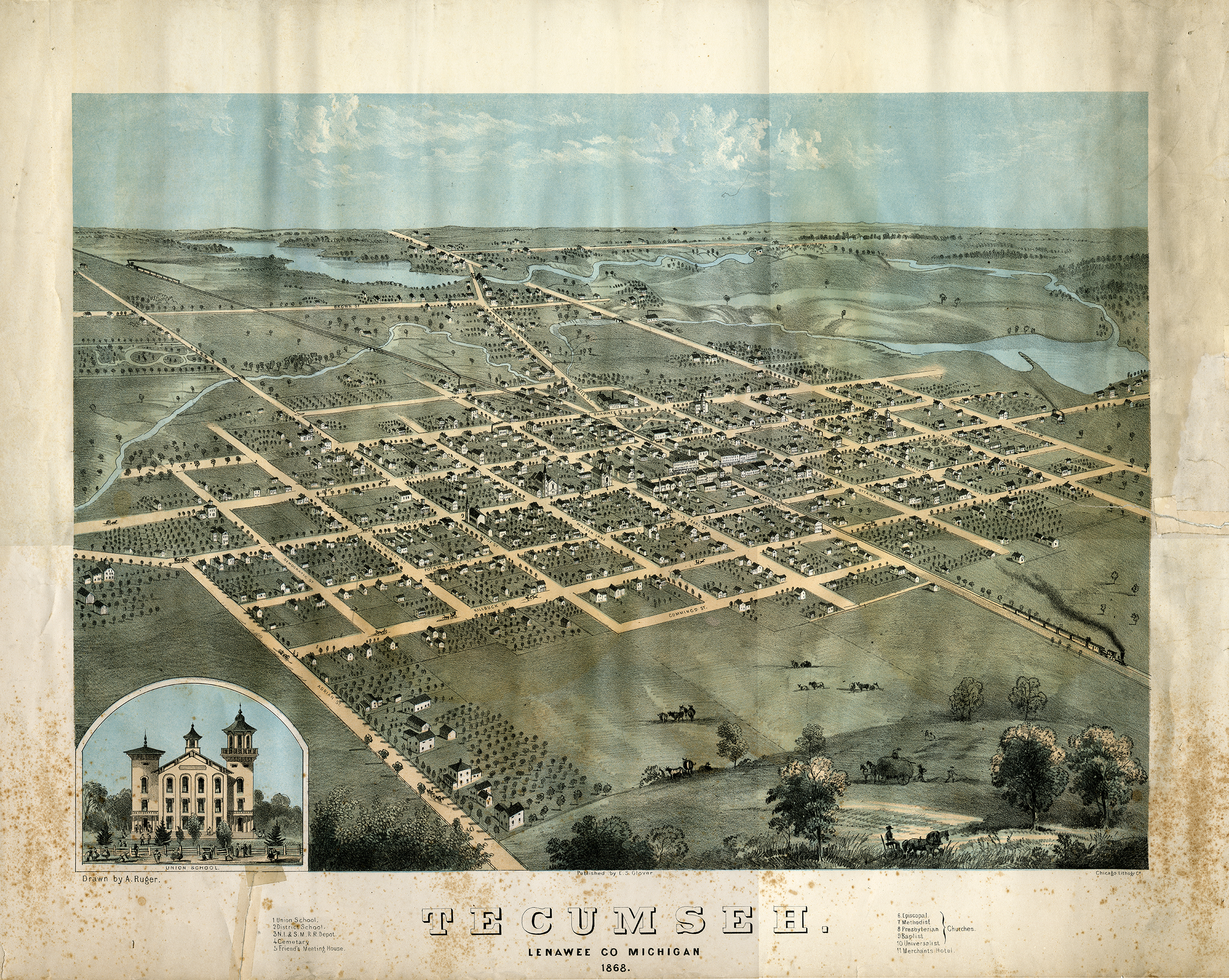
As business enterprises, bird's-eye views were drawn of cities where the viewmakers believed there would be a sufficient market for the map. Before the project began, a company would contact the local newspapers and a stream of coverage would be arranged. Shortly after the support of the local newspaper was secured, an announcement would appear in the paper informing the community that an artist would be coming to town to make sketches for a view. After a few weeks, the artist would present the sketches at a public gathering where orders for the printed views would be accepted.
The Clarke Historical Library has gathered the largest collection of Michigan bird's-eye views in the state. Thanks, in part, to funding made available from the Library of Michigan, these views have been scanned to be made more widely available. Researchers wanting a reproduction of these images should contact the Clarke Historical Library at clarke@cmich.edu.